
Genasys EVAC tracks and maps U.S. fires with significant activity over the last 10 days. This feature combines multiple active-fire sources into one up-to-date resource.
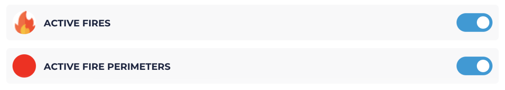
In EVAC, active incidents will appear as one of two categories: active fires and active fire perimeters.
-
Active Fires: Any fires with significant activity in the past 10 days. This includes smaller fires that are limited to a specific location or area (e.g., a car fire). All ‘Active Fires’ are represented as the ignition points. Fires that are less than 24 hours and contain only one data source are classified as emerging fires. Fires that have a mapped perimeter and/or multiple data sources are classified as a large incident.
-
Active Fire Perimeters: Larger incidents with significant activity in the past 10 days that have been mapped and therefore have an associated fire perimeter.
NOTE: All active fire perimeters will also have an associated active fire icon (latitude and longitude of the ignition).
These layers provide data for fires across the entire continental United States.
Viewing Active Fires and Active Fire Perimeters
To view all active fires and/or active fire perimeters, follow one of the two options below.
Option 1-
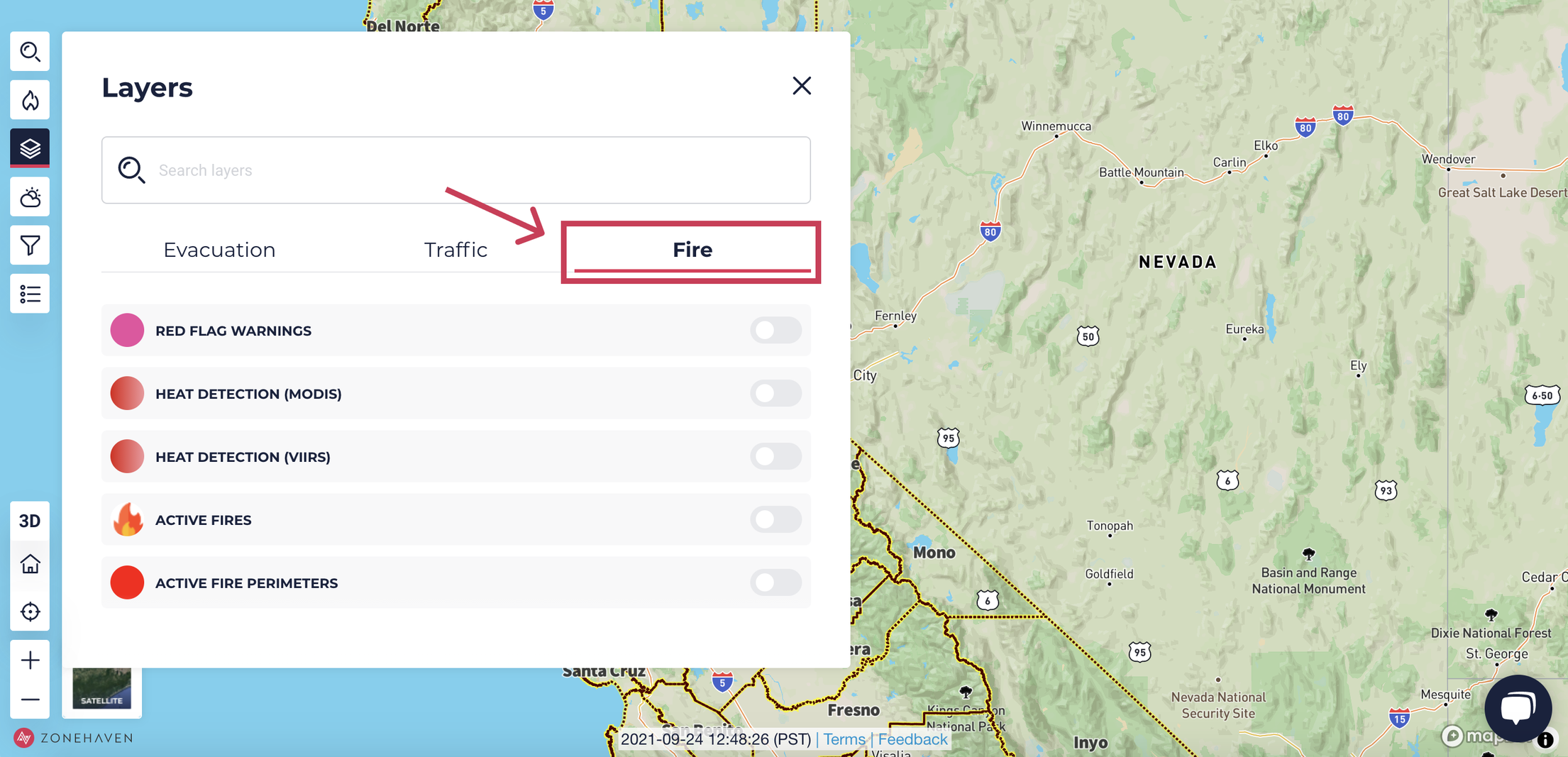
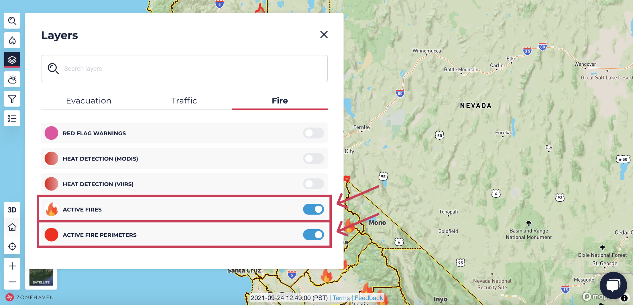
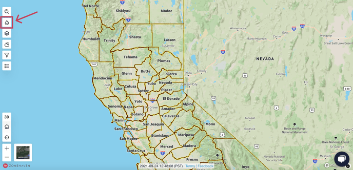
Open the Layers section, found in the left side bar. This will open the Layers window.

-
Select the Fire tab.
-
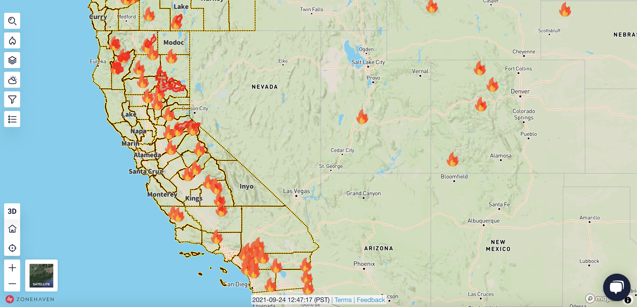
Activate the Active Fires and/or Active Fire Perimeters sliders to show the fires on the EVAC map. Active fires are represented by fire icons and active fire perimeters are represented by red plots.
Option 2
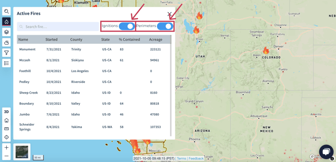
- Click on the Fires button in the left side bar. This will open the Fires window.
- Activate the Ignitions and/or Perimeters sliders in the top right to show the fires on the EVAC map. Active fires are represented by fire icons and active fire perimeters are represented by red plots.
Incident Details
For more information about an active incident, click on the associated fire icon. This will open a pop-up window with available details about the fire.
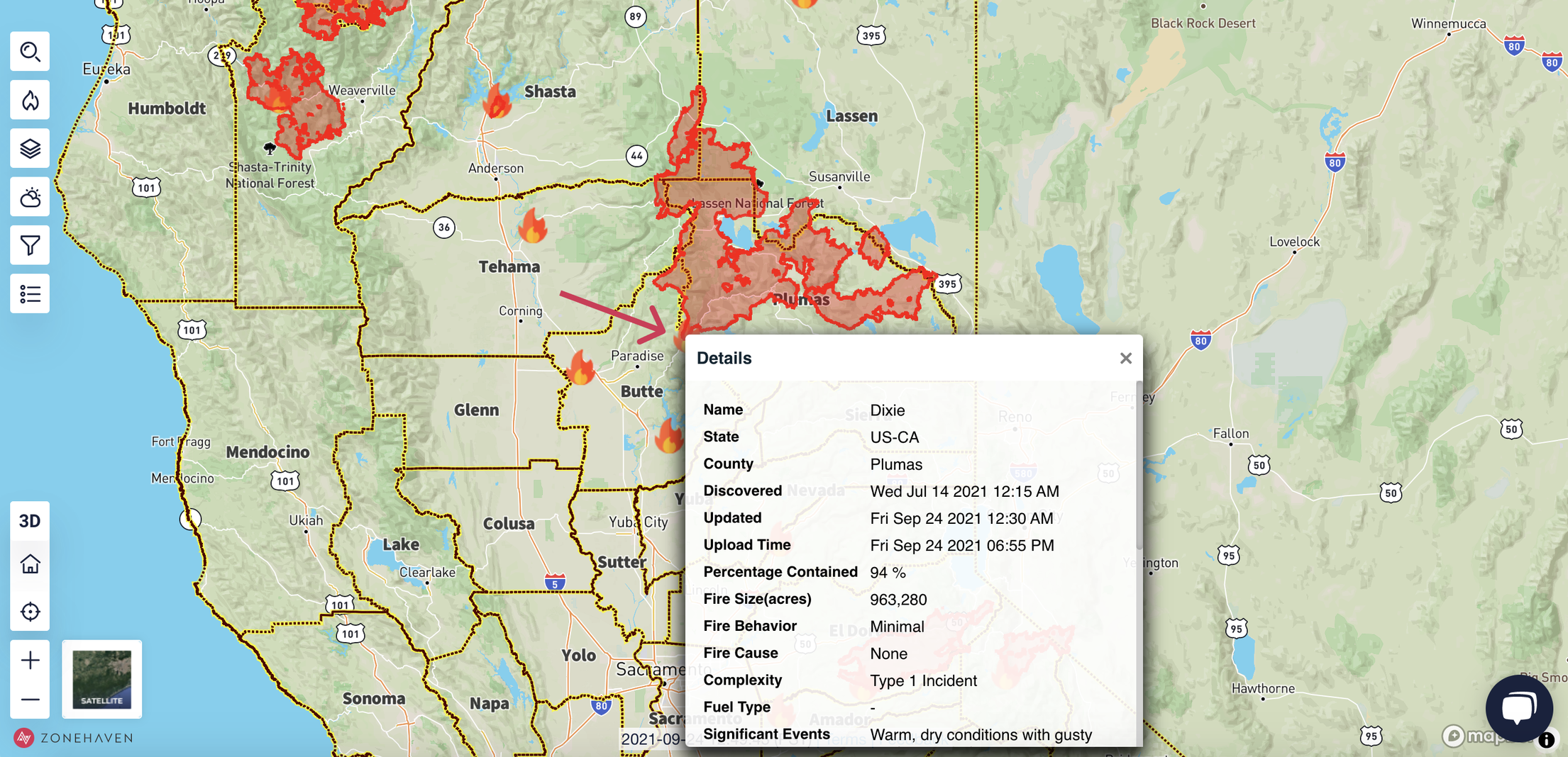
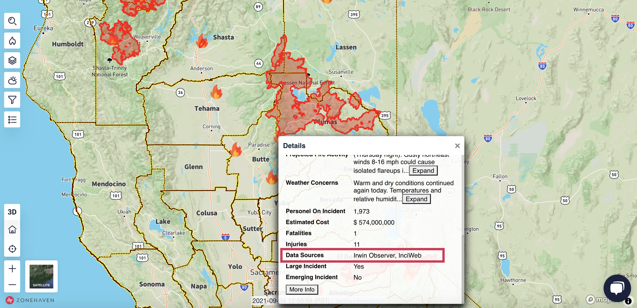
The data for the incidents is curated from a number of different sources. The specific Data Sources for a particular fire will be listed in the Details pop-up.
Incident Details Breakdown
|
Field Name |
Type |
Description |
|---|---|---|
|
Name |
word |
name of the fire |
|
State |
word |
location (state) of the fire |
|
County |
word |
location (county) of the fire |
|
Discovered |
time |
discovery time of the fire in the UTC Z format (Greenwich Time) |
|
Updated |
time |
time of the last incident update in the UTC Z format (Greenwich Time) |
|
Upload Time |
time |
time of the last refresh of Zonehaven’s data in the UTC Z format (Greenwich Time) |
|
Percentage Contained |
number |
percent of the incident contained; largest statistic among all data sources |
|
Size |
number |
fire size in acres; largest statistic among all data sources and fire perimeter area calculations |
|
Fire Behavior |
categorical |
a general category describing the manner in which the fire is reacting to the influences of fuel, weather, and topography; examples: minimum, moderate, active |
|
Cause |
categorical |
cause of the fire ignition; examples: lightning, campfire |
|
Complexity |
categorical |
complexity of the incident, where Type 5 requires less than 6 personnel to manage and Type 1 incident is the most complex, requiring national resources |
|
Fuel Type |
categorical |
predominant fuel(s) contributing to the incident; examples: grass, timber, shrub |
|
Significant Events |
description |
significant events that contributed to the fire progression; examples: precipitation, containment lines |
|
Projected Fire Activity |
description |
projected fire activity based on forecasted weather and any suppression activity |
|
Weather Concerns |
description |
a brief summary of how the current weather is affecting the incident and how the anticipated weather will affect the incident |
|
Personnel On Incident |
number |
the total number of personnel assigned; includes overhead, crew members, helicopter crew members, engine crew members, camp crew people, etc. |
|
Estimated Cost |
number |
estimated total incident costs to date for the entire incident based on currently available information; costs include estimates for all costs for the response, including management and support activities |
|
Fatalities |
number |
fatalities associated with the incident |
|
Injuries |
number |
injuries associated with the incident |
|
Data Sources |
categorical |
all data sources used to summarize the incident; sources: Irwin Observer, CalFire, InciWeb, FIRIS |
|
Large Incident |
binary (yes/no) |
defined as a large incident if there is an associated fire perimeter and/or there are multiple data sources for the incident |
|
Emerging Incident |
binary (yes/no) |
defined as an emerging incident if the incident started less than 24-hrs ago |
|
More Info |
url link |
button linked to authoritative sources; may be more than one |