
This article provides steps to connect to ZMS in QGIS.
The Zonehaven Map Service (ZMS) provides real-time access to the latest zone configurations and status (learn more).
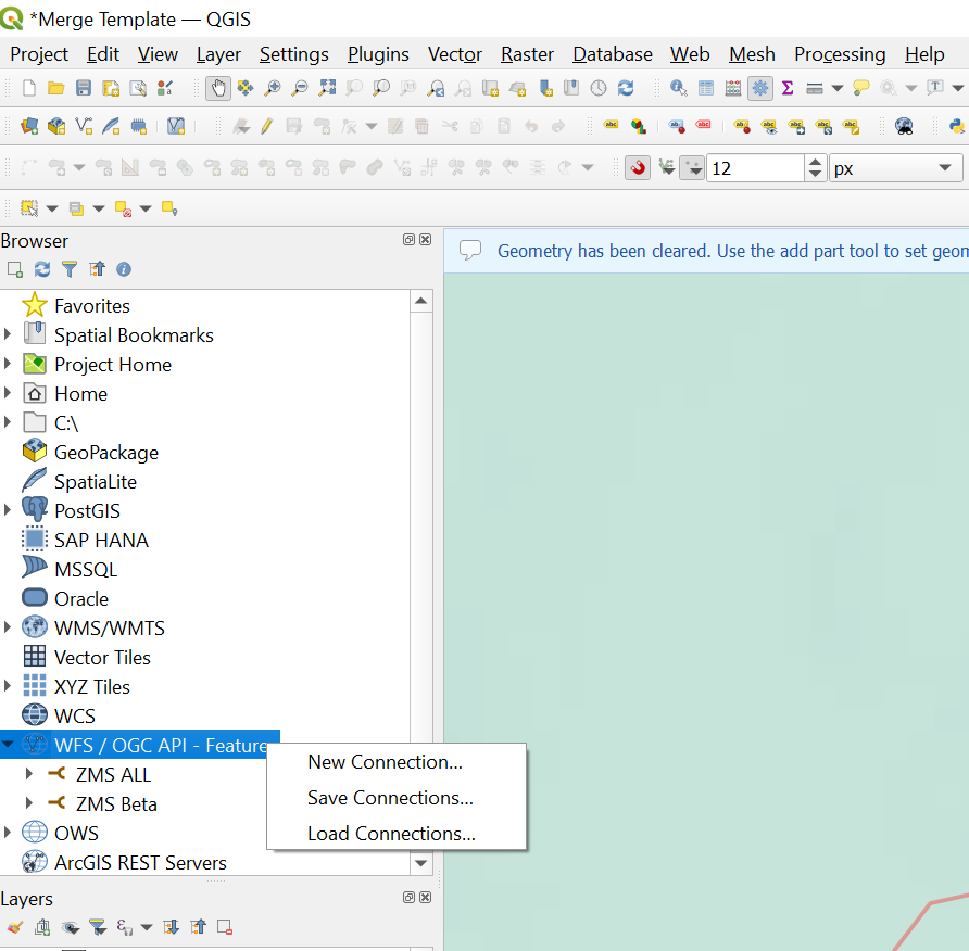
To connect to ZMS in QGIS, first you have to create your connection. In the data "Browser" find the 'WFS/OGC API - Feature' data type and select 'New Connection.'
Next, name your connection and enter the fully qualified URL, including the API key generated from your account at https://zms.zonehaven.com/.
Example of a fully qualified URL with API key (this link is for demonstration only and will not actually work).
https://zms.zonehaven.com/geoserver/z/wfs?authkey=5Qgafsdkh9odf37FHIADPSaaI0AeNqZvS9kampYLTEIcSvFZBQTJNbuQGHnlPv9CE3xQQs7a3E9KGrygdADSFAfiafHGBo5nwtzkl3cknPvOFOIAUYDFA31cVfhbo90v9J70ncflG

Finally, you should see your Connection Name, select the name and see the evacuation_zone_status feature. Drag this into the map and see the live zones.
